I know this is a little obsessive but I'm sure there are several of you who will find this interesting.
Last night Channel 12 News showed there was an estimated 8" of rain that fell around the headwaters of the Medina River.
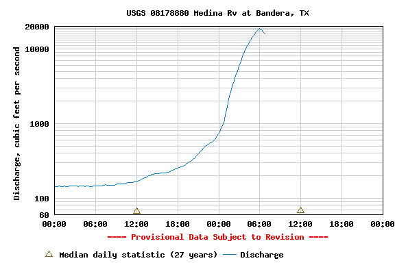
According to the USGS website the Medina River at Bandera had a peak of 18,000 cfs this morning. We still have more rain on the way but I highly doubt it will be enough to maintain 18,000 cfs. I would be very surpised if the flow at Bandera was not below 10,000 cfs by Saturday afternoon.
Before last yesterday afternoon the Medina River at Bandera was consistently 130-180cfs for the last 30 days. Assuming the gage at Bandera is correct, the 18,000 cfs peak is 100X greater than the average cfs for the last 30 days.

Here's a link to the USGS real time data.
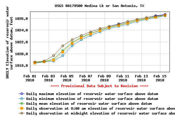
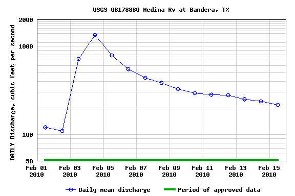
http://waterdata.usgs.gov/nwis/uv?cb_000...ite_no=08178880The rain storm we had in early February resulted in a peak flow at Bandera around 1,800 cfs. This mornings peak flow was 18,000 cfs is 10X the peak flow in early February, Medina Lake came up about 8 feet in a two week period in early February.
Here's a couple graphs for early February.
Medina Lake Level February 1st to February 15th
 Medina River at Bandera Level (the daily data only shows mean daily flow, it doesn't show the peak)
Anyone have any predictions on how many feet Medina Lake will come up over the next two weeks?

