Posted By: Captain Nathan Beabout
Cedar Bayou/Vinson Slough; 10/8/17 - 10/09/17 12:48 AM
Ok, I know there has been a lot of talk about the Bayou, and what happened since the storm. We loaded up the kids today and headed down there, because I wanted to see for myself and also all the post I have read have had no pictures to go along. I am going to try to write this in coordination with the pictures. Keep in mind we are currently under a Coastal Flood Advisory and the water is 2-3 feet higher than our normal tide……..
Coming in from Mesquite bay all the way to where the bayou starts to funnel down is the same, stay more on the east side. The two flats are still on the west side like they have always been.
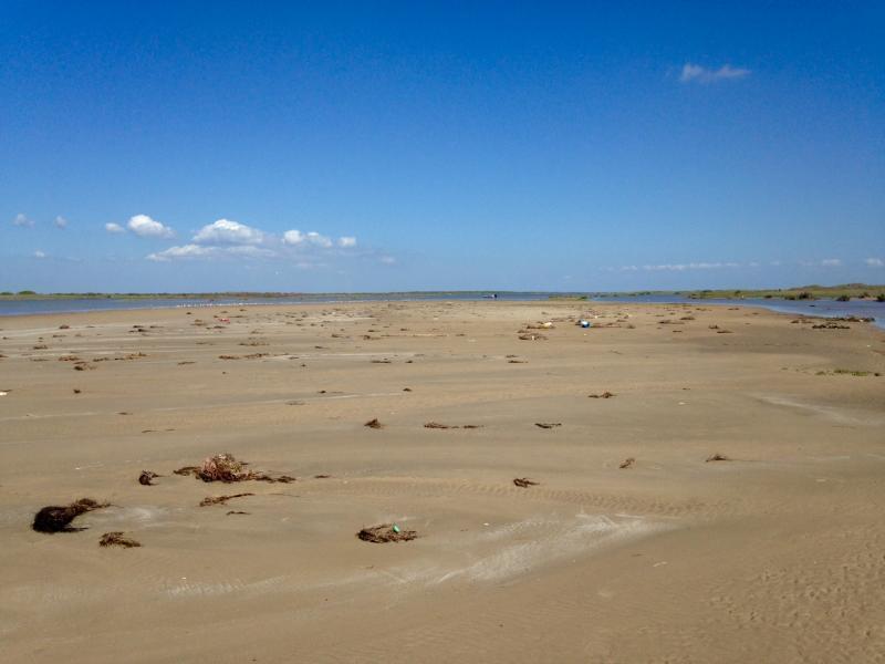
From where the dredged bayou funnels down up to where everybody parked and camped on the east bank by the sign is as close as you can get your boat, it is about knee deep, and out in front of where the sign was is dry hard sand. It looks like the sand dunes from the sign to the beach and all the way to where the dredged bayou curved west are gone and filled in the bayou.
Now in saying that, the original Cedar Bayou on the west bank is about waist deep and if you hang a hard right before the dredged bayou funnels down you can run your boat down the original bayou up to the point where the two tall telephone poles are on the west bank.
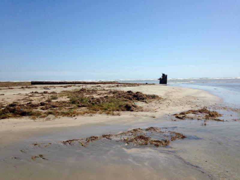
The original bayou goes out into the gulf, where it meets the gulf I could not walk across, it’s about 25 yards wide, but if you walk out into the gulf 20-30 yards you can cross it is only knee deep.
From where the original bayou goes into the gulf, Vinson’s slough is a good Ľ to ˝ mile walk south down the beach. From the surf line to the west bank that Vinson’s slough used to run down is about 200-250 yards of dry sand.
Vinson’s slough runs straight into the gulf and the curve that used to be back up the slough where the sign was is now more or less a straight shot. Vinson’s is about 75-100 yards across and is knee to thigh deep out to the first sand bar.
There is a lot of bait in both cuts and a lot of bait on the gulf side, but unfortunately when our water returns to normal I think everything will be close to knee deep and from each mouth out to the surf will be sheet water. Coming into the bayou where the white pvc pipe was on the east side, I think will be the closest you can get to where we used to park. And that will be a 500+ yard walk, just to get to where we used to park.
I hope this information helps anybody looking to go down there fishing or just looking. I would approach with extreme caution as there is going to be a lot of shallow sand humps when our water falls out.


Coming in from Mesquite bay all the way to where the bayou starts to funnel down is the same, stay more on the east side. The two flats are still on the west side like they have always been.
From where the dredged bayou funnels down up to where everybody parked and camped on the east bank by the sign is as close as you can get your boat, it is about knee deep, and out in front of where the sign was is dry hard sand. It looks like the sand dunes from the sign to the beach and all the way to where the dredged bayou curved west are gone and filled in the bayou.
Now in saying that, the original Cedar Bayou on the west bank is about waist deep and if you hang a hard right before the dredged bayou funnels down you can run your boat down the original bayou up to the point where the two tall telephone poles are on the west bank.
The original bayou goes out into the gulf, where it meets the gulf I could not walk across, it’s about 25 yards wide, but if you walk out into the gulf 20-30 yards you can cross it is only knee deep.
From where the original bayou goes into the gulf, Vinson’s slough is a good Ľ to ˝ mile walk south down the beach. From the surf line to the west bank that Vinson’s slough used to run down is about 200-250 yards of dry sand.
Vinson’s slough runs straight into the gulf and the curve that used to be back up the slough where the sign was is now more or less a straight shot. Vinson’s is about 75-100 yards across and is knee to thigh deep out to the first sand bar.
There is a lot of bait in both cuts and a lot of bait on the gulf side, but unfortunately when our water returns to normal I think everything will be close to knee deep and from each mouth out to the surf will be sheet water. Coming into the bayou where the white pvc pipe was on the east side, I think will be the closest you can get to where we used to park. And that will be a 500+ yard walk, just to get to where we used to park.
I hope this information helps anybody looking to go down there fishing or just looking. I would approach with extreme caution as there is going to be a lot of shallow sand humps when our water falls out.