|
Forums59
Topics1,039,142
Posts13,959,864
Members144,192
| |
Most Online39,925
Dec 30th, 2023
|
|
 Lowrance and Navionics
#12488288
11/02/17 12:04 AM Lowrance and Navionics
#12488288
11/02/17 12:04 AM
|
Joined: Jun 2005
Posts: 237
Royce Sanders jr
 OP
OP
Outdoorsman
|
|
OP
Outdoorsman
Joined: Jun 2005
Posts: 237 |
Im wanting to take an image from google earth and put on my GPS unit. I have a 7300hd chartplotter I use for my GPS, my chip is from 05-06 so i dont know if I can even do it. I dont have any kind of special apps or nav planner. any help or ideas would be greatly appreciated.
|
|
|
Re: Lowrance and Navionics
[Re: Royce Sanders jr]
#12488304
11/02/17 12:18 AM
|
Joined: Mar 2009
Posts: 2,218
B.Hollingshead
Extreme Angler
|
|
Extreme Angler
Joined: Mar 2009
Posts: 2,218 |
There is a way to download google to a SD card and put straight on your graph and using overlay, I'm not sure how to do it I run multiple lakes on mine but a friend builds them for me. This is what it looks like on my graph but I can scroll the whole lake. 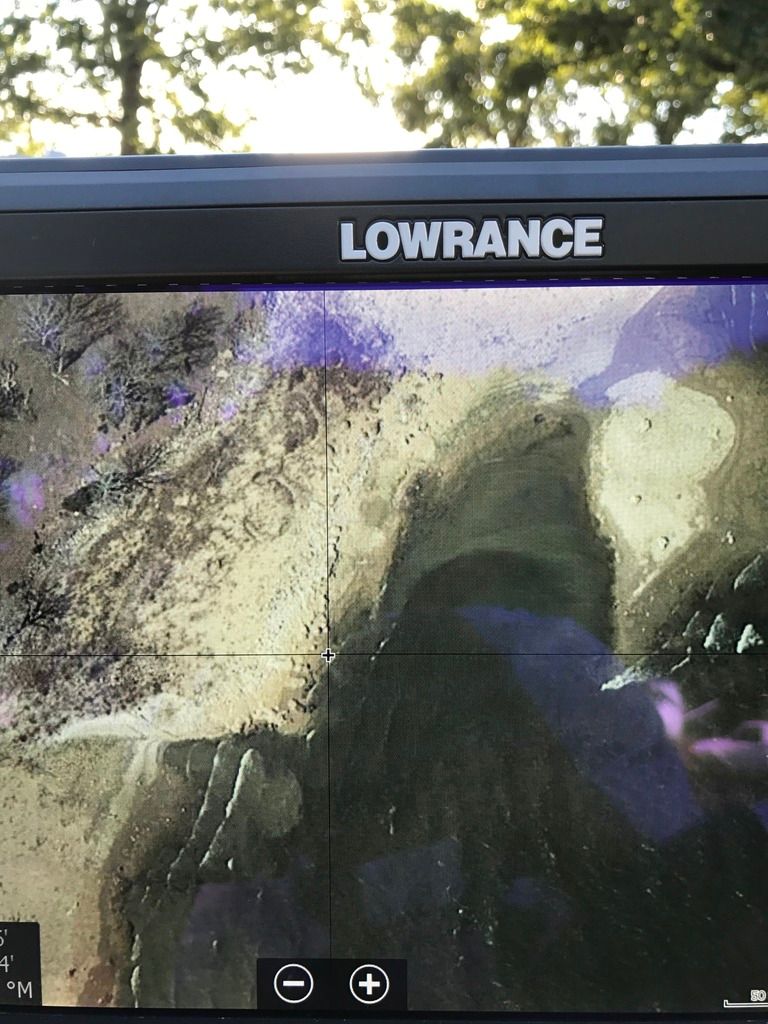
Last edited by B.Hollingshead; 11/02/17 12:31 AM.
Branden Hollingshead
38-DD's and counting
|
|
|
Re: Lowrance and Navionics
[Re: Royce Sanders jr]
#12488537
11/02/17 02:38 AM
|
Joined: Jun 2005
Posts: 237
Royce Sanders jr
OP
Outdoorsman
|
|
OP
Outdoorsman
Joined: Jun 2005
Posts: 237 |
what I did was marked stuff on Navionics website, then screen shot it and over layed on Google Earth to get the waypoints. But I was thinking if I could just put the screen shot on my unit it would be easier then have to add the waypoints in manually one by one.
|
|
|
Re: Lowrance and Navionics
[Re: Royce Sanders jr]
#12488827
11/02/17 11:42 AM
|
Joined: Jul 2011
Posts: 9,200
the skipper

TFF Celebrity
|
|
TFF Celebrity
Joined: Jul 2011
Posts: 9,200 |
I'm not sure you can do it on that unit. I know you can on the hds but I don't think you can on the older units
|
|
Moderated by banker-always fishing, chickenman, Derek 🐝, Duck_Hunter, Fish Killer, J-2, Jacob, Jons3825, JustWingem, Nocona Brian, Toon-Troller, Uncle Zeek, Weekender1
|
