Posted By: Nathan_Flovin
viewing lakes before creation? - 11/17/16 03:05 AM
How can i look at lakes before they were made? I want to be able to view lakes before they were made so i can see the structure and type of land there was before they were there. Ive tried google earth but it only goes to 1995 and the lakes are still there. any sugestions?
Posted By: eggs'isled
Re: viewing lakes before creation? - 11/17/16 03:13 AM
Go to the US Geological department, they have surveys prior to inundating the land... It'll cost ya a few bucks...
Posted By: Donald Harper
Re: viewing lakes before creation? - 11/17/16 04:13 AM
I would start here and give them a call to see what they have on file. The web-site is not showing what you are asking for; but they will be able to tell you who to go to for the maps before the lakes you are interested in were built.
http://www.texasmapstore.com/Texas_Geolo...w6m7RoCDbTw_wcB
Posted By: ryand75
Re: viewing lakes before creation? - 11/17/16 05:12 AM
This shows aerials photos back to the 50's i believe and Topo maps back to the 30's
http://www.historicaerials.com/aerials.php?op=home
Posted By: CCTX
Re: viewing lakes before creation? - 11/17/16 01:44 PM
Caltopo.com is another good one for this.
Posted By: Kay Dyson
Re: viewing lakes before creation? - 11/17/16 08:08 PM
Hell's Gate at PK
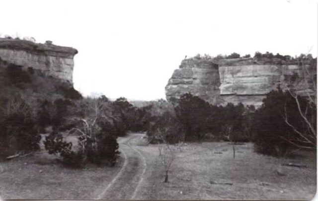
That is such a cool picture...
Posted By: JD/76708
Re: viewing lakes before creation? - 11/17/16 08:51 PM
Hell's Gate at PK
That is such a cool picture...
Can you say "funnel point"?....

Posted By: GIG'EM AGGIES
Re: viewing lakes before creation? - 11/17/16 10:34 PM
Hell's Gate at PK
Awesome, where/how did you get that ?
