|
Forums59
Topics1,039,137
Posts13,959,750
Members144,192
| |
Most Online39,925
Dec 30th, 2023
|
|
 Re: Navionics Platinum Detail?
[Re: Wayne P.]
#11202219
11/03/15 12:01 AM Re: Navionics Platinum Detail?
[Re: Wayne P.]
#11202219
11/03/15 12:01 AM
|
Joined: Apr 2015
Posts: 6,885
04champ

TFF Celebrity
|
|
TFF Celebrity
Joined: Apr 2015
Posts: 6,885 |
In my opinion there's zero reason to buy the platinum over the premium. Here's a little better deal on eBay. You pay no tax either. Works out to be about $40 less than Basspro of Academy. 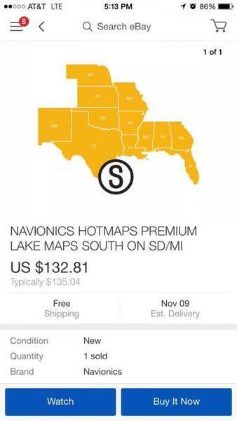 If you want the extra map layer of Sonar Charts, you cannot get that with the Premium version. So on the Premium cards, you can only update with Navionics updated data.... not user submitted data?
|
|
|
Re: Navionics Platinum Detail?
[Re: 04champ]
#11202220
11/03/15 12:03 AM
|
Joined: Nov 2010
Posts: 5,101
Wayne P.

TFF Celebrity
|
|
TFF Celebrity
Joined: Nov 2010
Posts: 5,101 |
In my opinion there's zero reason to buy the platinum over the premium. Here's a little better deal on eBay. You pay no tax either. Works out to be about $40 less than Basspro of Academy. If you want the extra map layer of Sonar Charts, you cannot get that with the Premium version. So on the Premium cards, you can only update with Navionics updated data.... not user submitted data? Yes, read my first post on this thread.
Helix 12 CHIRP MEGA SI+ GPS G3N and G4N, 1198c SI, SOLIX 10 SI G3,
Helix 8 MEGA SI+ GPS G4N, SOLIX 12 SI and G3, MEGA 360, MEGA LIVE TL, RC-1
|
|
|
Re: Navionics Platinum Detail?
[Re: WillieKetchum]
#11202272
11/03/15 12:36 AM
|
Joined: Oct 2013
Posts: 1,027
SRitchey
Extreme Angler
|
|
Extreme Angler
Joined: Oct 2013
Posts: 1,027 |
I just had this same problem with mine this weekend. Turn off Fish n Chips. The road beds, bridges, etc will show up. I do the same thing and my Platinum chip is less that 2 years old. If I'm running down the lake or searching while I sit the Fish n Chip feature is usually off. When I get to the area I'm going to fish I will turn it on. Wish Navionics could get this figured out so all the detail is available with it on.
Steve
1999 ChampioN 203 - 2011 250hp Mercury Optimax Pro XS
2-10" Helix & 1-10" Garmin Livescope Plus - Ultrex 36/112
|
|
|
Re: Navionics Platinum Detail?
[Re: SRitchey]
#11202302
11/03/15 12:49 AM
|
Joined: Nov 2010
Posts: 5,101
Wayne P.
TFF Celebrity
|
|
TFF Celebrity
Joined: Nov 2010
Posts: 5,101 |
I just had this same problem with mine this weekend. Turn off Fish n Chips. The road beds, bridges, etc will show up. I do the same thing and my Platinum chip is less that 2 years old. If I'm running down the lake or searching while I sit the Fish n Chip feature is usually off. When I get to the area I'm going to fish I will turn it on. Wish Navionics could get this figured out so all the detail is available with it on. Sonar Charts is USER GENERATED DATA, not Navionics data. No one doing sonar logs has those features to add to the maps. As they have time, some features will be added to the Sonar Charts maps that are Navionics data, but not the contours. The Sonar Charts program is so popular world wide that they are kept busy just getting the logs processed. Adding the Sonar Charts Live program just added more to their work load. Another thing, since Sonar Charts is NOT done by Navionics and the data is only supplied by user sonar logs, no one knows if and where any part of those maps is accurate unless the one using the map is the one that supplied the data. Don't bet your hull and lower unit on those maps until you verify with your sonar that they are accurate anywhere.
Helix 12 CHIRP MEGA SI+ GPS G3N and G4N, 1198c SI, SOLIX 10 SI G3,
Helix 8 MEGA SI+ GPS G4N, SOLIX 12 SI and G3, MEGA 360, MEGA LIVE TL, RC-1
|
|
|
Re: Navionics Platinum Detail?
[Re: 361V]
#11202365
11/03/15 01:20 AM
|
Joined: Nov 2010
Posts: 5,101
Wayne P.
TFF Celebrity
|
|
TFF Celebrity
Joined: Nov 2010
Posts: 5,101 |
Example of the above post. All map companies do not collect data for every square foot of terrain, even the USGS. They collect data at intervals and then fill in between the data points (interpolate )with fake lines. This is part of a Sonar Charts map that I did on a lake with no data of any kind available. Every place I did not log got contours too. The only accurate data is what was below my transducer and GPS antenna. This is a Google Earth track map after a couple dozen sonar logs. Only what is directly under the red lines is accurate, every contour not under the red lines is fake (interpolated).  This is one area of that contour map, note the map curser position and GPS co-ordinates:  After some of my sonar logs were processed, I noticed that area was not accurate since I had not logged it. I am very familiar with that lake since I have fished it since it first was opened to fishing. This is the track for that area I did to correct it:  This is the corrected contour map for that area:  I did this post to show that you cannot assume any part of any Sonar Charts maps are accurate. It is entirely the result of user generated sonar logs. You must verify with your sonar what/where the accuracy is and is not.
Helix 12 CHIRP MEGA SI+ GPS G3N and G4N, 1198c SI, SOLIX 10 SI G3,
Helix 8 MEGA SI+ GPS G4N, SOLIX 12 SI and G3, MEGA 360, MEGA LIVE TL, RC-1
|
|
|
Re: Navionics Platinum Detail?
[Re: 361V]
#11202404
11/03/15 01:43 AM
|
Joined: Nov 2010
Posts: 5,101
Wayne P.
TFF Celebrity
|
|
TFF Celebrity
Joined: Nov 2010
Posts: 5,101 |
Another example I just remembered. When the Sonar Charts program was first started just about every body of water got preliminary contours to be adjusted by sonar logs. None of those lines were accurate. This particular body of water was a scanned paper map with 8' contours that got the preliminary contour lines. Even the shore line is incorrect, as I was scanning, my position icon was shown on land several times. This is the original scanned paper map with a rockpile note I added with Community Edits:  This is the preliminary contour map when Sonar Charts started not based on any sonar/GPS data.  This is after I did sonar logs in that area:  This is after I did some more logs to fix some errors:  This is after I gave Navionics the GPS location of an island and rock pile that was not show and the lake outline was redrawn using Google Earth since some of my recordings were shown land with the original map. They add docks and ramps when that is done. 
Last edited by Wayne P.; 11/03/15 01:45 AM.
Helix 12 CHIRP MEGA SI+ GPS G3N and G4N, 1198c SI, SOLIX 10 SI G3,
Helix 8 MEGA SI+ GPS G4N, SOLIX 12 SI and G3, MEGA 360, MEGA LIVE TL, RC-1
|
|
|
Re: Navionics Platinum Detail?
[Re: 361V]
#11202866
11/03/15 01:26 PM
|
Joined: Jun 2011
Posts: 15,795
921 Phoenix
TFF Guru
|
|
TFF Guru
Joined: Jun 2011
Posts: 15,795 |
Thanks shotgunwilly. "Fish n Chips" shows ON. Never really knew how much detail I was missing until my son & I were looking for the 515W old road bed along the bridge on a very slow day last Wednesday. Looking online @ Navionics online map there is tons of detail I'm not getting. Basically only contour lines is what I get. Had this Platinum chip in a "new" Bird 898C SI on my old boat 5 years ago. Kept the chip. The Platinum was the latest & greatest at the time. Maybe this detail was not included then? What chip are people running that shows the detail on their website? Just feel like I'm defiantly missing a setting or step. TY. I think you can just upgrade your card online for 99.00 thru Navionics to get the detail you want.
|
|
|
Re: Navionics Platinum Detail?
[Re: 361V]
#11202918
11/03/15 01:49 PM
|
Joined: Nov 2008
Posts: 7,618
361V
OP
TFF Celebrity
|
|
OP
TFF Celebrity
Joined: Nov 2008
Posts: 7,618 |
Kind of a different question on the same topic: how does Lake Master compair with Navionics as far as "extra detail" on a lake like Fork? Not talking about the contour lines or shading capabilities. How is LM on the extra detail such as creeks, road beds, bridges...?
|
|
|
Re: Navionics Platinum Detail?
[Re: 921 Phoenix]
#11203733
11/03/15 09:23 PM
|
Joined: Oct 2009
Posts: 1,135
Corey Stanley
Extreme Angler
|
|
Extreme Angler
Joined: Oct 2009
Posts: 1,135 |
Thanks shotgunwilly. "Fish n Chips" shows ON. Never really knew how much detail I was missing until my son & I were looking for the 515W old road bed along the bridge on a very slow day last Wednesday. Looking online @ Navionics online map there is tons of detail I'm not getting. Basically only contour lines is what I get. Had this Platinum chip in a "new" Bird 898C SI on my old boat 5 years ago. Kept the chip. The Platinum was the latest & greatest at the time. Maybe this detail was not included then? What chip are people running that shows the detail on their website? Just feel like I'm defiantly missing a setting or step. TY. I think you can just upgrade your card online for 99.00 thru Navionics to get the detail you want. With a chip that old, you would need to call Navionics Customer service and explain you want to update an old Platinum chip. They will allow you to pay over the phone and will send you a new Navionics Platinum for the $99, since the old one can not handle the updates online, but with the replacement card, it will be able to in the future. Or another option is that you can buy the Updates card for $99, which is activated by your old card and will become a blank Nav+ card ready to download any areas you want. The only cards that have the Sonar Charts layer is going to be the Platinum or the Nav+.
|
|
Moderated by banker-always fishing, chickenman, Derek 🐝, Duck_Hunter, Fish Killer, J-2, Jacob, Jons3825, JustWingem, Nocona Brian, Toon-Troller, Uncle Zeek, Weekender1
|


